To most outsiders in the 1950s, the Buraimi Affair was a passing curiosity, a faraway squabble about territorial rights in a remote corner of southeast Arabia known as the Buraimi Oasis. The British government backed its protégés, Abu Dhabi and Oman, against Saudi Arabia, while the United States government took a mediating role.
However, as the Time magazine report suggested, there was another aspect to the dispute: it was rumoured that Buraimi was “floating on a pool of oil.” For oil operations, the disputed territory was separated into three parts: Aramco would operate in the southern part, Petroleum Development (Trucial Coast) in the northern part, with a “no go” area in between, which became known unofficially as “No Oil Man’s Land.” A 15-mile exclusion zone was imposed around the Buraimi Oasis, placing the area out of bounds.
As often happens when politics mix with oil, the situation was complicated, especially when a band of inquisitive geologists appeared on the scene. That is exactly what happened in October 1955 when my father, geologist Mike Morton, arrived with a field party in the vicinity of Sunaina in northern Oman, about 25 miles south of Buraimi, and began setting up a camp in the desert.
Striking Camp
The geologists worked for Petroleum Development (Oman), which was an associate of the British-led Iraq Petroleum Company. The oil men were intrigued by the prospect of finding oil in the region and had spent years trying to find a way through a thicket of tribal rivalries and international maneuvrings. In the field, the lure of an interesting rock formation could exert a powerful hold on a geologist’s mind and here lay a predicament: what should they do when an interesting feature beckoned them to cross a line?
The tribal difficulties of the past had left a blank space on the geological map: the geologists had previously managed to reach central Oman and the Buraimi Oasis, but access to the part in between – the desert plain known as Dhahirah – had been ruled out. However, one of the villages in the area, Sunaina, had declared its allegiance to the sultan of Oman, and the area was now deemed safe, though “safe” was a relative term – the geologists were accompanied by an escort of soldiers from the Muscat and Oman Field Force led by Major Malcolm Dennison.
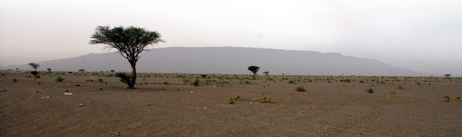
They loaded two Nubian trucks and departed Ibri in central Oman, making their way northwest. They stopped at the gates of a village where they were surrounded by hordes of armed tribesmen who invited them for tea or coffee – offers they politely declined. They reached the gravel plain within sight of Jebel Hafit, a large hogback that shadows the Buraimi Oasis, and stopped to set up camp. However, this proved to be an ill-tempered affair since they had just returned from annual leave and their tent-building skills were rusty. At least it was a secluded spot, with no spies peering over the nearest hillock to keep watch and relay news of their progress.
As it happened, the geologists were not alone for long. As night fell, they heard the sound of an engine coming along the Ibri track and looked up to see an approaching truck. The vehicle came to a halt in the cloud of dust and out stepped the driver who reported to Major Dennison. He took his message and turned to Mike: “Sorry, you have to strike camp. There’s a possibility the Saudis may come this way.” With a British-led force entrenched around the Buraimi Oasis, there was a real danger of the geologists being caught up in a firefight. Without further ado, they struck camp and returned to the safety of Ibri, where they waited on events.
A Buraimi Reception
The parade ground at Ibri, where the geologists set up their new camp, was a place where “strident bugle notes drifted and faded in the evening air.” They bided their time while the military went about their routines to a background of palm trees and mountains in the distance. A few days later, news arrived from Buraimi: there had been a battle, and the crisis had passed. The villagers returned to their traditional ways as diplomats worked behind the scenes to resolve the underlying dispute.
The geologists, being anxious to proceed before some distant panjandrum got wind of their plans and tried to stop them, did not hesitate. They flew makeshift red flags of Oman on their Land Rovers lest some trigger-happy sentry might shoot them by mistake.
“The drive on to Buraimi was stimulating in so far as it was illicit, and its outcome not only unknown but possibly terminal,” observed Don Sheridan, one of the geologists in the party.
Dusty tracks linked the mud-walled villages of the Buraimi Oasis, and ancient water channels fed its date gardens, lending a sense of timelessness to the place. The geologists made their way to Bait Turki, named after the Saudi official who had once resided there, which was now the fortified base for military operations in the area. Two British officers with revolvers strapped to their thighs greeted them, followed by liaison officer Edward Henderson, who was dressed in “immaculate whites.” Mike knew him well, having worked with him on an expedition to Jebel Fahud the year before, but this was no fond reunion. Henderson – like the two officers beside him – was unhappy to see the sand-encrusted oil men. Mike engaged them in small talk and “the conversation rallied somewhat, although Edward, too, was put out by our presence,” recalled Sheridan.
In truth, they were among the last people the military wanted to see. Henderson’s status was different from when the geologists had last seen him: then he had been employed by IPC, now he was taking his instructions from the British government. It was clear that London wanted the outside world to think the Buraimi Affair had nothing to do with oil, even though the international press had often reported that the oasis was “floating on a pool of oil.” Nevertheless, the geologists needed no second bidding, taking in a brief reconnaissance of Wadi Jizzi before returning to Ibri.
Buraimi was strategically important, since whoever controlled the oasis could dominate the whole region, including those parts that were good oil prospects. But there was one place beyond anyone’s control: the great sands of the Rub al-Khali, the Empty Quarter – so treacherous that “not even Allah has been there.”
The Light of an Arabian Moon
Once the travel restrictions had been lifted, the geologists were able to go about their business with only the terrain as their enemy – drifting sands, dust storms and remoteness all made working in the desert a difficult task. The lack of exposed rocks saw an increasing reliance on geophysical parties and their machines. Even so, there were still doubts about the accuracy of maps and the precision of boundaries, and oil companies were not always sure about the extent of their concession areas. There had been no borders in the desert before the arrival of the oil men, but now it was essential to have clarity for operations to proceed without misunderstandings, or worse.
One day in 1956, Doug Manning, a surveyor working for an IPC contractor, was laying down magnetometer and gravimeter lines on the edge of the Rub al-Khali – one of the most remote places on Earth – when he was astonished to see through the eyepiece of his theodolite the outline of a drill rig structure only a few hundred meters away. The rig was believed to be within IPC’s concession area and so, taking his readings and returning to camp, Manning reported the matter to his party chief. Other incidents followed, leading to a stand-off when a British officer commanding an Arab detachment of troops came upon an Aramco field party in the desert and ordered them at gunpoint to leave. They did so under protest, leaving their equipment to rust in the sands.
Such occasions were not always so fraught. In the same year PDTC had a survey party working near the Qatar border. Two members of the party were out on a reconnaissance when they came across an Aramco crew in what was supposedly Abu Dhabi territory. The meeting was polite and, indeed, the PDTC men invited the Americans to visit them later in the day. That evening, two of them came over the dunes to the PDTC camp and, as one of the PDTC surveyors John Vale later recalled, “We gave them plenty of beer before they left.” By the time the border patrol troops arrived to investigate, the American crew had long since disappeared, having pulled back to Saudi Arabia.
The politicians might have raised a disapproving eyebrow over this fraternising between geologists but really, what was the harm in sharing a few cold beers under the light of an Arabian moon?
The Sands of Time
For many years, the Buraimi Affair was an intractable dispute that exercised the finest diplomatic minds of a generation, leading one British diplomat to remark: “If Calais was imprinted on Queen Mary’s heart, Buraimi is certainly imprinted on mine,” alluding to the loss of the last English possession in Europe in 1558.
My father never forgot it: in 1969, when we visited the oasis together, he told me: “Whatever you do, don’t mention the Buraimi Affair.” It was rather like that scene in the comedy series “Fawlty Towers” when hotel proprietor Basil Fawlty promises not to mention the war.
The belief that the Buraimi Oasis was floating on a pool of oil proved to be a myth. The real oil prospects lay in western Abu Dhabi (today part of the United Arab Emirates) and central Oman. The first onshore oil in Abu Dhabi was found at Murban in 1959 and in Oman at Yibal in 1962. The Buraimi dispute rumbled on until the Treaty of Jeddah in 1974 when Saudi Arabia and the UAE agreed on oil rights and borders, and a similar agreement was reached with Oman. Today, the area is best known for its main conurbation, Al Ain, the fourth-largest city in the UAE.
I took my late father’s advice to heart and more than 40 years would pass before I felt able to write about the Buraimi Affair: my book, “Buraimi: The Struggle for Power, Influence and Oil in Arabia,” was published in 2013. Today a fence separates the UAE from Oman, ostensibly to stop smuggling and illegal immigrants, but representing a complete reversal of the traditional scenario where there were no formal boundaries, no lines on maps, only tribes who fully understood the limits of their grazing areas and the number of their water wells.
The arrival of the oil men and the granting of oil concessions brought a new imperative to define the boundaries between states, primarily between Oman, Abu Dhabi and Saudi Arabia. It is a lesson to be drawn from the history of oil – that wherever oil is found, real boundaries will be drawn.
Acknowledgement: In gratitude to the late Don Sheridan whose book,”Fahud: the Leopard Mountain” provided the direct quotes in this article.